Severe weather
photos and videos by
meteorologist & stormchaser J.R. Hehnly
Email questions or comments
.
All images and
videos on this site
Use by permission only.
My May 3, 1999 tornado video is now
available for purchase.
Please visit this page for more information.
May 3, 1999 RAW Video Trailer (click to play)
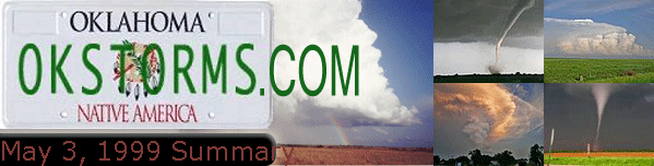
May 3, 1999
I began the day
early checking conditions around Oklahoma.
Unfortunately, I
was working and knew I wouldn't get to leave to chase untill around 4:00. Told my partner,
Jim Webb, that it looked like a bull's eye down around Lawton and to be ready to go. He had
school though, and I would have to go alone. (I had spent the whole day before at the top of
Mt. Scott waiting for something to happen, but nothing ever did!).
Finally, around
4:00 I left Midwest City. By this time the anvil tops of the
storms near Lawton are already
being blown into the city, and lower level clouds obscure any view of the storm. I make my
way down I-44 as the first tornado reports are coming in from spotters NW of Lawton. They
quickly dissipate and I'm wondering if I'm going to be too late to see anything.
After
passing through Chickasha I once again hear spotters west of Cyrill reporting funnels.
Finally I catch a glimpse of one through the trees to the west. I try to video, but there
are too many trees and hills to get a good shot, besides I'm about 6-7 miles away. I exit
I-44 at the Cyrill exit and head north.
After getting lost on the back roads of Cement I
make my way NE towards Chickasha. As I head north out of Laverty (is that a town?) I see a
new funnel coming down to the NE. It quickly condenses to the ground and becomes very
large. It appears to be headed straight for Chickasha. I try to get to the only paved road
into Chickasha, but it is being blocked by a fire truck (downed power lines?). I shoot some
pictures from the top of the hill then backtrack to a dirt road heading east.
Heading for
Chickasha I see another tornado drop next to the main one. It's an incredible sight,
two significant tornadoes at the same time! I
arrive on the west side of Chickasha to see the main tornado still churning along on the ground
to my NE. Traffic is already bad from people out in their
cars eager to see it.
I finally get to highway
81 but have lost sight of the tornado. I drive into Amber dodging baseball sized
hailstones on the road, then decide that it would be too hard to continue and maneuver
around the Interstate and the South Canadian River (later
when I review video I realize that what I thought was just a low wall
cloud to my east was actually the tornado as an F5 doing damage in
Bridge Creek).
I'm hearing reports of a new storm near Fort Cobb and decide to
head towards it. About the time I get back to SH81 I see a backlit tornado from that
storm. It looks pretty big, but far away. I make my way down county roads to just NE of
Lake Chickasha where I ran into Charles Edwards and R.J. Evans from Cloud 9 Tours. We get
out and watch the storm for about 5 minutes.
I decided to intercept the storm as it passed
northwest of us. The wall cloud parallels me to my left as I approach SH152. There is a
lot of rotation and after seeing a few dust spin-ups a tornado finally forms. It doesn't
last long and dissipates as the rotation crosses the road in front of me.
I get on SH152
and head east when another tornado forms to the SE. I'm traveling along with an armada of
chasers as it crosses the highway in front of me. Another good looking tornado then forms
and I get out to take some pictures.
I eventually end up at I-40 and Cimarron Road around
9:00 PM to see my last tornado of the night NE of El Reno,
which was moving at about 60 MPH (the tornado, not El Reno).
What an evening! I just wish
there hadn't been the loss of life or destruction. My sympathies to all the families
affected.