May 26, 2008
South-central Kansas


Summary:
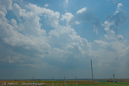
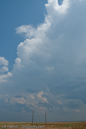
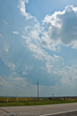
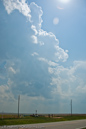
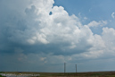
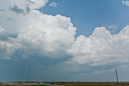
This moderate risk day looked promising. Upper 60 dewpoints, nice shear, and some remnant outflow boundaries from the previous day made the area of southern Kansas look somewhat favorable for tornadoes. I arrived in Ashland around 2:30 and found plenty of cumulus and strong southerly winds. We waited about an hour and a half before the towers developing around us finally broke the cap. We stayed with the cell nearest us, following it towards Greensburg. We did see a nice lowering on this storm, but no rapid rotation or funnels were seen. As we approached Greensburg, the cell began back-building and we soon found ourselves in some moderate hail. Unfortunately, one hailstone was large enough to crack the windshield. We decided to stay in Greensburg and let the storm proceed to the east, following in behind it. After the hail core had passed to the north side of the highway, we punched through the heavy rain and emerged near Pratt. We saw some non-rotating lowerings, but by the time we got to Pratt the storm looked extremely outflow dominant and so I decided to abandon it and head south. Of course a few minutes later there were reports of a brief tornado in Pratt. I don’t see how considering the structure of the storm at that time.
Questions or comments? Please contact J.R. Hehnly