May 5, 2004
Severe weather photos and videos by
meteorologist & stormchaser J.R. Hehnly
Email questions or comments .
All images and videos on this site

Use by permission only.

Home Up


May 5, 2004

Click on any photo to see a larger version

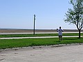
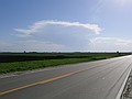
Left out very early to head north. The only possible storms looked to be in the Nebraska area.


Made it to Nebraska before 10:30 am!


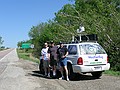
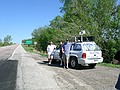
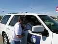
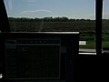
Around noon we stopped in Council Bluffs for lunch and to check out the current conditions.


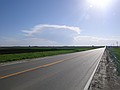
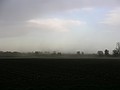
Almost 4 pm and we finally get some radar returns to our west.


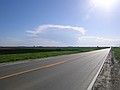
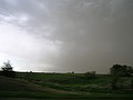
The surface flow from the south was sustained 30mph.


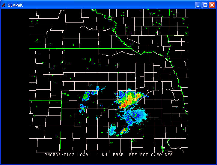
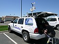
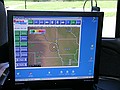
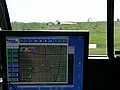
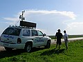
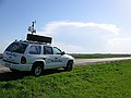
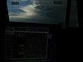
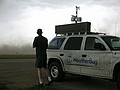
In Norfolk we were able to get some high speed data. The dryline was evident on radar and the cells had formed behind it. We decided to intercept the cell where they would hit the dryline, encountering more favorable air.


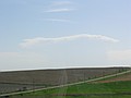
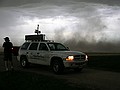
Target cells have been spotted and we are in intercept mode.


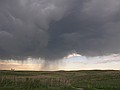
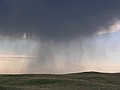
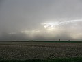
The easternmost cell dissipated and we caught some nice virga from it as we passed by on the way west.


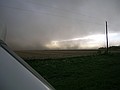
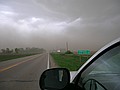
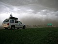
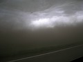
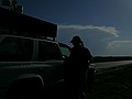
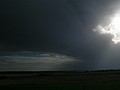
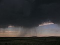
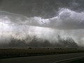
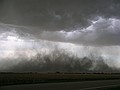
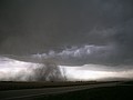
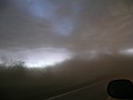
We finally intercepted the western cell around 7:15pm, the outflow was beginning to pick up dust to our west, approaching fast. In only a few minutes we were engulfed in a sandstorm. Visibility dropped to zero!

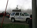
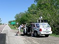
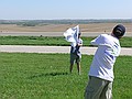
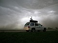
The truck was covered in mud after the first wave of dirt flew by.

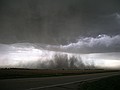
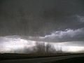
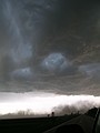
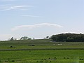
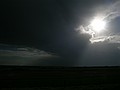
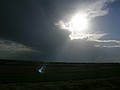
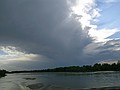
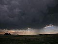
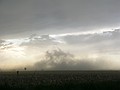
After the dust past to our east it began getting caught up in the storms inflow and began rising up toward the cloud base. It was evident there was no rotation here, but if there had been it would have been very easy to see.


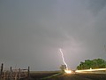
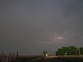
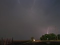
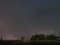
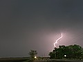
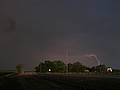
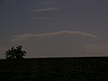
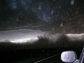
10 miles south of Grand Island as the sun set we were treated to a few nice lightning bolts.


Map of 040505_rpts's severe weather reports

Wind Reports
Time Speed Location County State Lat Lon Comments
2230 65 6 S NORTH PLATTE LINCOLN NE 4105 10077 (LBF)
0036 60 DANNEBROG HOWARD NE 4112 9855 ROOF BLOWN OFF A SHED IN TOWN. ALSO NEAR ZERO VISIBILITY IN BLOWING DUST. (GID)
0050 UNK ST. PAUL HOWARD NE 4121 9846 TREES DOWN IN ST. PAUL...ONE TREE DOWN ON A VEHICLE. (GID)
0115 UNK GRAND ISLAND HALL NE 4092 9837 TREES DOWN AT THE INTERSECTION OF BROADWELL AND CHARLES. (GID)
0123 UNK SILVER CREEK MERRICK NE 4133 9767 POWER LINES DOWN AT 6TH AND ORMSBY. (GID)
0155 UNK GRAND ISLAND HALL NE 4092 9837 SCATTERED TREE DAMAGE ACROSS HALL COUNTY...WITH SEVERAL COMMUNITIES WITHOUT POWER. POSSIBLE STR LIGHTNING. (GID)
0210 UNK HASTINGS ADAMS NE 4059 9839 TREES AND POWER LINES DOWN AROUND ADAMS COUNTY. POWER OUT TO THE TOWNS OF KENESAW AND JUNIATA. (GID)
0245 UNK 3 W RISING CITY BUTLER NE 4120 9735 8 CAR AND TRUCK ACCIDENT AT JUNCTION OF HIGHWAYS 81 AND 92 BETWEEN RISING CITY AND SHELBY ON CO (OAX)
0343 UNK DE WITT SALINE NE 4040 9692 SEVERAL TREES DOWN (OAX)
0343 70 4 SW WESTON SAUNDERS NE 4115 9680 NO DAMAGE REPORTED (OAX)
0359 62 WILBER SALINE NE 4048 9696 MINOR TREE DAMAGE (OAX)
All Times UTC
Wind Gusts in MPH

May 2, 2004 May 3, 2004 May 5, 2004 May 6, 2004 May 7, 2004


Home March 27, 2004 April 9, 2004 April 21, 2004 WeatherBug 2004 May 12, 2004 May 13, 2004 May 18, 2004 May 23, 2004 May 24, 2004 May 26, 2004 May 29, 2004 June 12, 2004 July 2, 2004 July 5, 2004 October 29, 2004


Send your questions or comments to