|
||||


| |||||
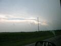
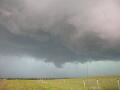
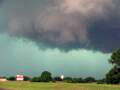
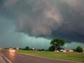
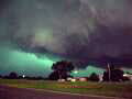
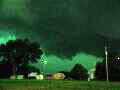
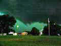
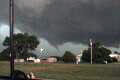
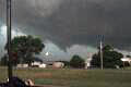
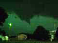
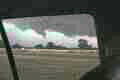
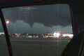
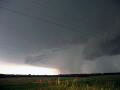
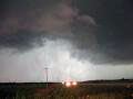
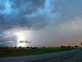
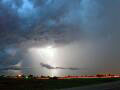
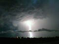
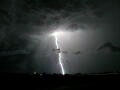
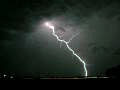
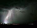
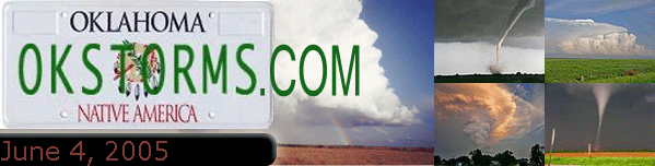
June 4, 2005 - South-central Oklahoma, Marlow TornadoClick on any photo to see a larger versionI decided to stay in Oklahoma City for the duration of the day. I was scheduled to work all day, but had arranged to get off early to chase storms that would develop in Oklahoma. I left home at 4:15 headed southwest on I-44 but it soon became apparent that the storms were going to fire along and east of the interstate. I decided to take US 62 south through Newcastle and Blanchard to stay in front of the storms. We stopped a couple of times near Dibble to see which storm was going to become dominant and finally made a decision to get south toward the storm approaching the Marlow/Duncan area, this was about 5:30. By 6:00 we were hearing radio reports of a rotating wall cloud and funnel near Pumpkin Center, now 30 miles to our west. There was so much cloud debris and precipitation that we could not see any part of the base of the storm although we were now hearing of a large tornado on the ground. We finally got a good view of the storm just southwest of Marlow. The earlier tornado had dissipated, but the storm seemed to be reorganizing. It looked like every local in the county was out on Hwy 7 to see the storm. People were standing outside in the lightning yelling at their kids to stay in the car! We stayed just in front of the storm and traveled back east toward US 81. As we neared the highway the wall cloud wrapped back up and produced a funnel. From my vantage point I could not see any debris but scanner traffic was reporting power flashes at this time, indicating the tornado was in contact with the ground just west of Marlow. I was also hearing reports of large hail just to my west so I made the decision to go north through Marlow to get to Hwy 29 eastbound. I made it through just east of the approaching wall cloud and traveled east many miles in the powerful outflow blowing from the northwest. Fortunately the power lines were on the south side of the highway in case any of them snapped. After getting on the inflow side again we stopped for some more pictures. This time there were more chasers and media than locals, I think. We ended up at Interstate 35 near dark and decided to call it a day. On the way back I got some great lightning shots just south of Norman.
|
|