My May 3, 1999 tornado video is now
available for purchase.
Please visit this page for more information.
May 3, 1999 RAW Video Trailer
Interactive
Chase Route
Most of these pictures are video captured off of Hi8 tape.
A couple are photo scans.
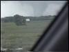
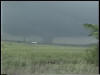
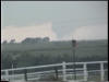
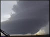
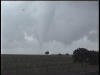
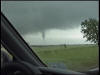
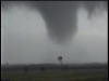
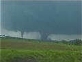
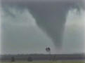
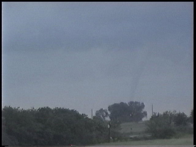
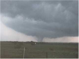
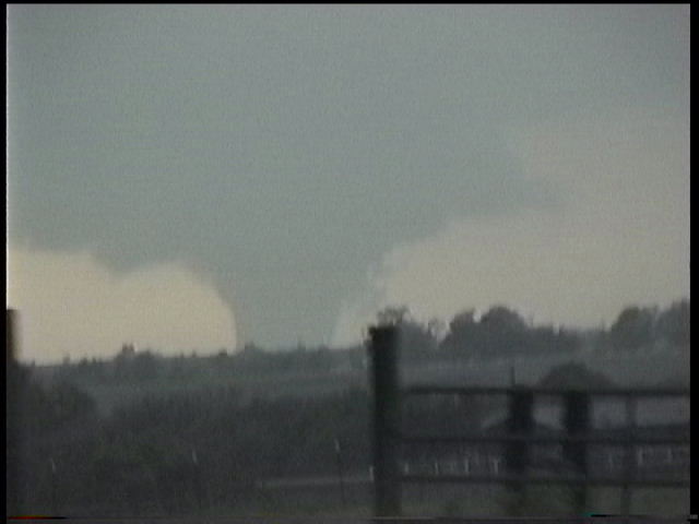
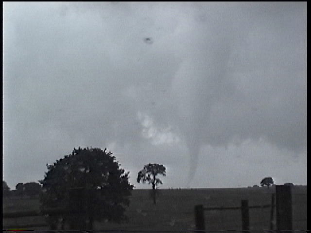
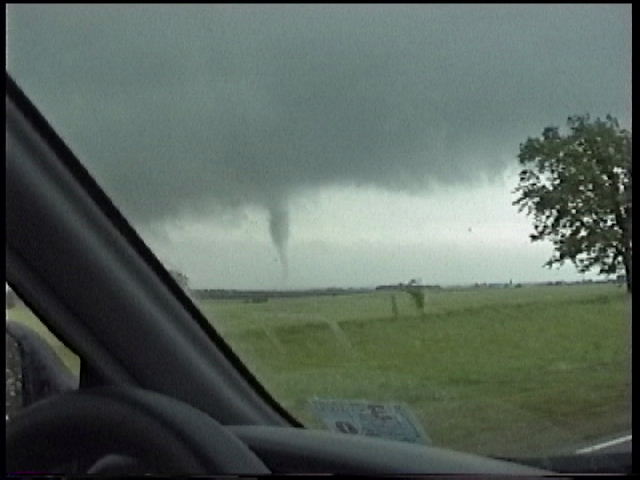
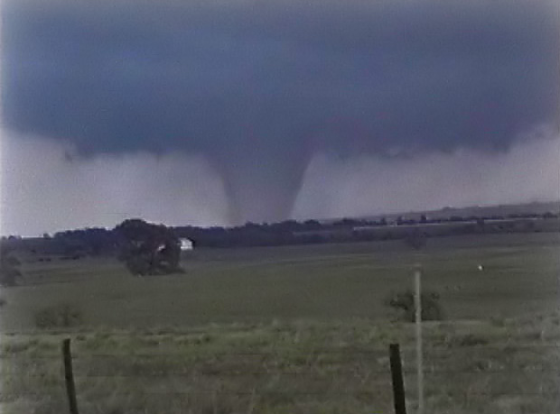
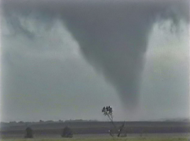
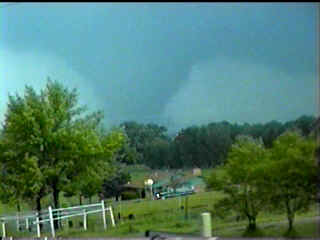
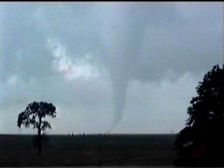
Cyril Tornado
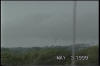
Tracks shown as A3,
A4 on NWS map

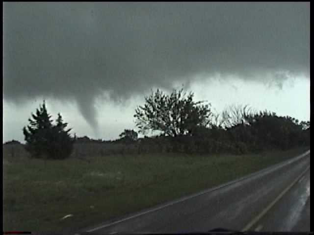
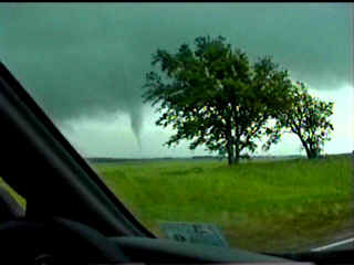
Hard to see. I-44 near Cyril exit looking W.
5:20-5:30 PM CDT
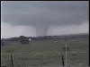
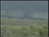
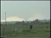
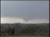
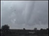
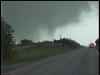
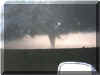
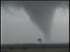
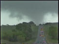
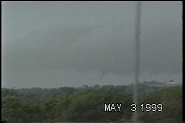
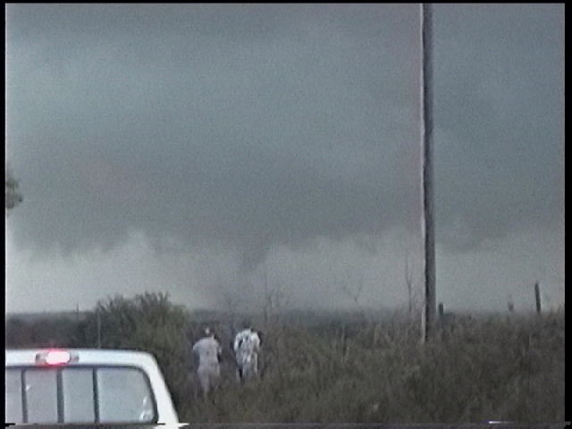
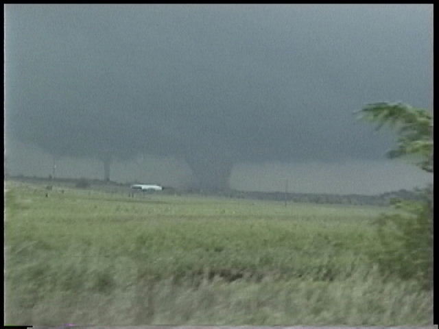
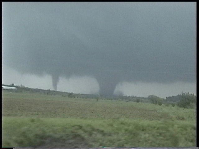
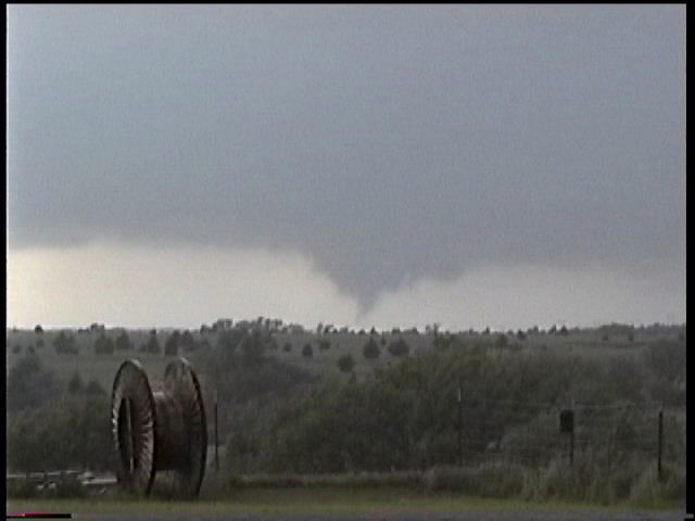
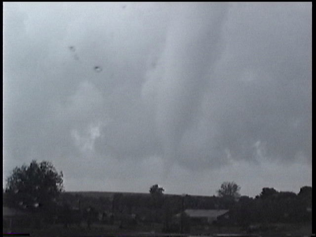
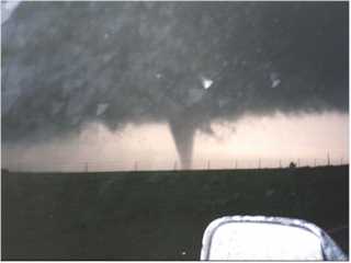
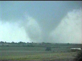
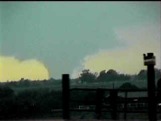
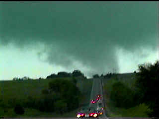
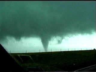
Chickasha Tornado
Track shown as A6-A8 on NWS map
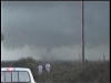

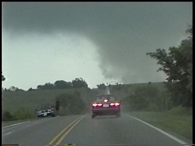
NS276 6 miles SW of Chickasha looking NE.
5:50 PM CDT
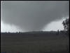
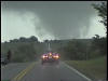
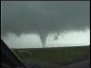
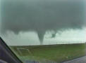
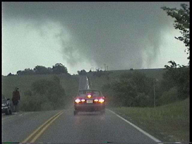
NS276 6 miles W of Chickasha looking NEE.
5:55 PM CDT

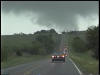
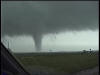
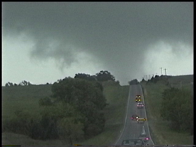
NS276 6 miles W of Chickasha looking ENE. 6:00 PM CDT
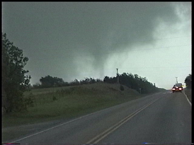
NS276 6 miles W of Chickasha looking E. 6:04
PM CDT
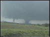
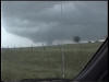
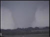
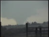
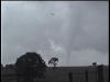
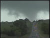
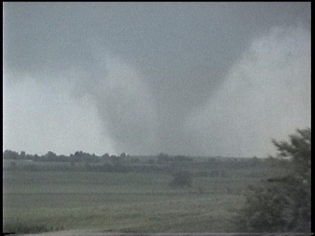
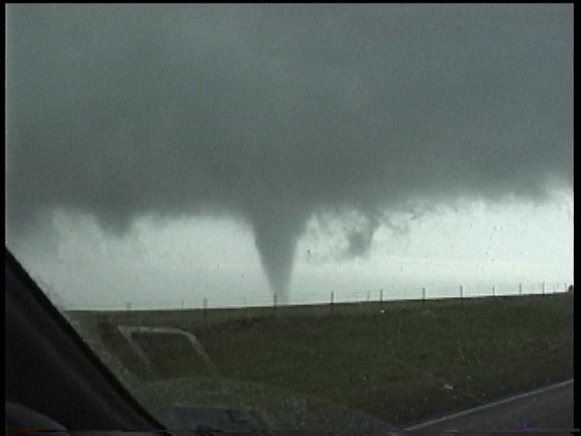
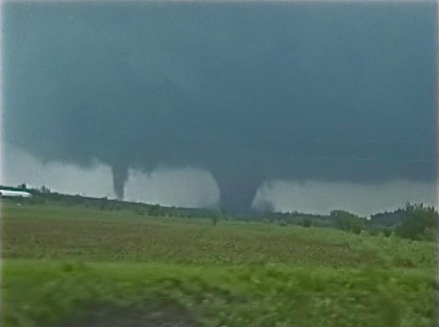
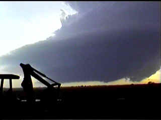
EW137 4 miles W of Chickasha looking NNE.
6:08 PM CDT
Note the satellite tornado to the left. This is shown as A7 on NWS map.
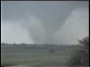
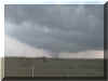
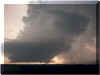
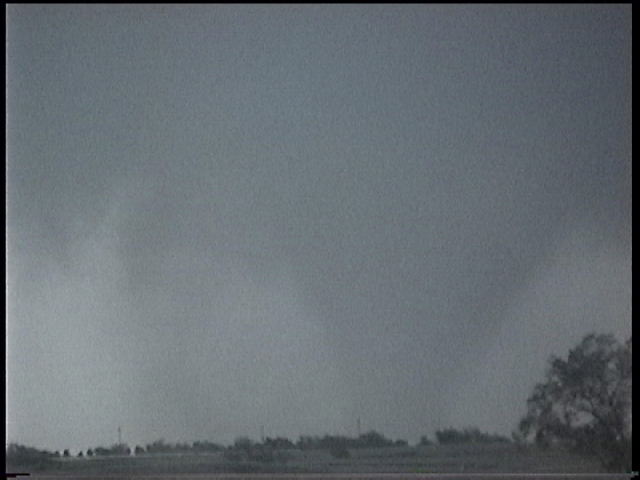
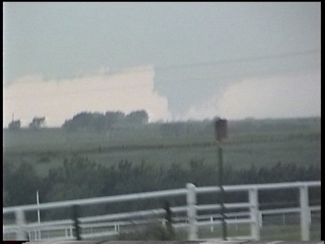
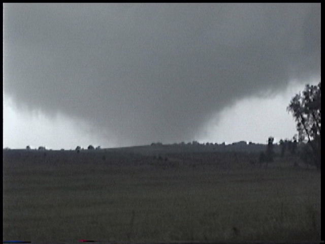
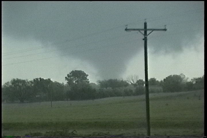
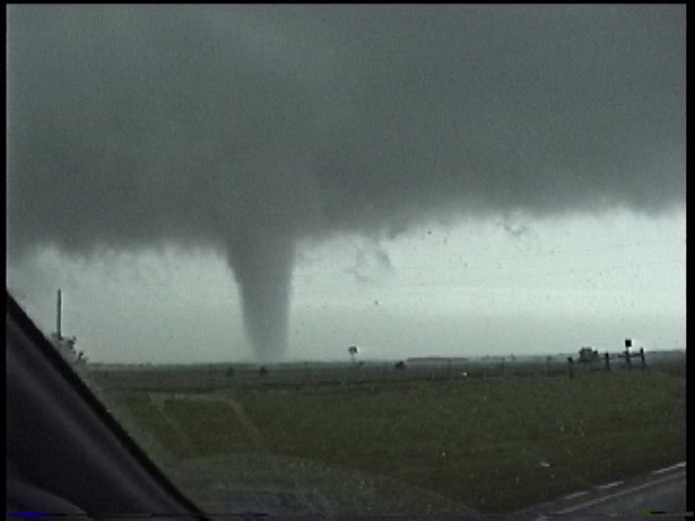
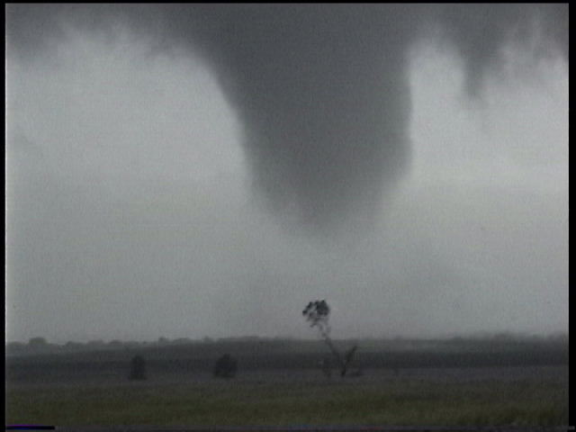
Corner of SH92 and EW137 in Chickasha looking
NE. 6:15 PM CDT
This is the tornado that would go on to do
major damage in Oklahoma City and Moore.
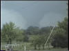
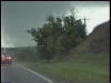
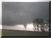
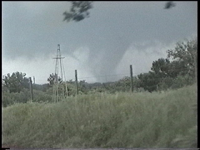
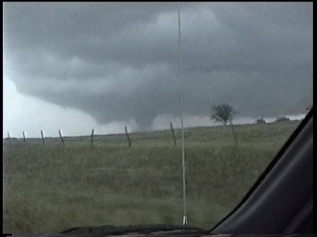
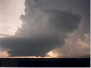
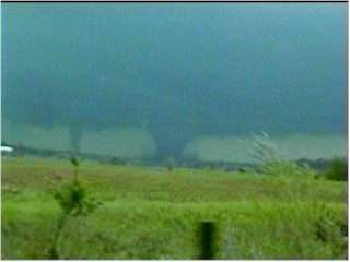
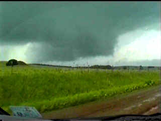
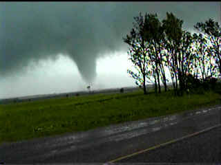
Anadarko / Fort Cobb Tornado
Tracks shown as B3-B10
on NWS map
SH 81 and EW128 looking W. 6:50 PM CDT
NS275 and EW127 looking W. 7:10 PM CDT
NS275 and EW127 looking W. 7:12 PM CDT
NS275 (Caddo/ Grady Co. Line) near EW120
looking NW. 7:20 PM CDT
Track shown as B7
on NWS map
NS275 (Caddo/ Grady Co. Line) near EW119
looking NW. 7:35 PM CDT
Track shown as B8
on NWS map

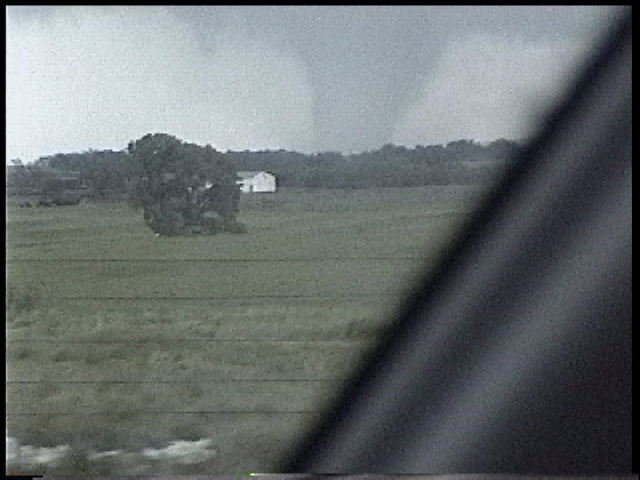
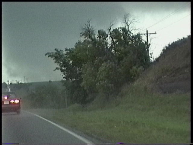
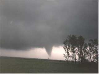
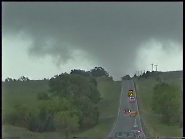
SH152 6 miles W on Minco looking SE. 7:38 PM CDT
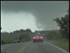
SH152 5 miles W of Minco looking E as tornado crosses highway. 7:45 PM CDT
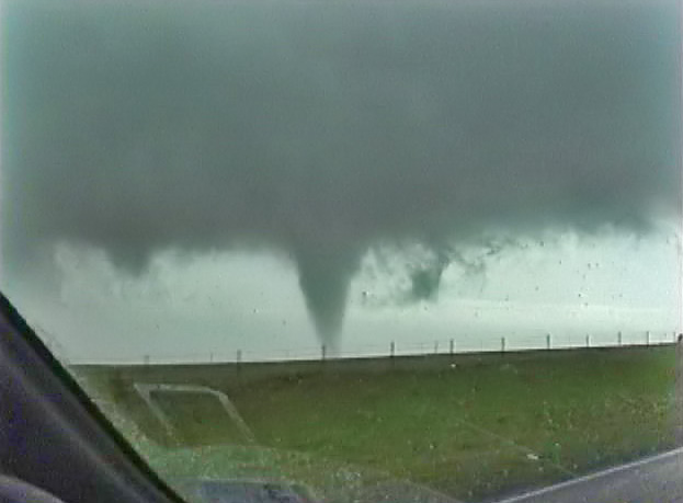
SH152 4 miles W of Minco looking NE. 7:48 PM
CDT
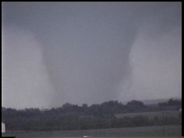
SH152 3 miles W of Minco looking NE. 7:49 PM
CDT
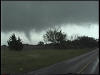
SH152 3 miles W of Minco looking NE. 7:49 PM
CDT
El Reno Tornado
Track shown as B16 on NWS map
After dark, VERY hard to see.
I-40 at Cimarron Road looking NW. 8:35 PM
CDT
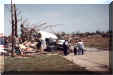
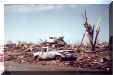
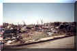
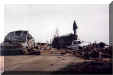
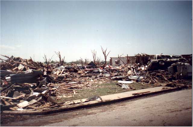
Here are photos of some of the damage in the Moore, OK area.
Here is my video of some of the damage in Midwest City, Moore, and southeast Oklahoma City taken May 4, 1999.

These are some enhanced versions of the video captures
| 


